3 releases (breaking)
| 0.3.0 | Mar 4, 2023 |
|---|---|
| 0.2.0 | Jun 16, 2022 |
| 0.1.0 | Mar 13, 2022 |
#349 in Visualization
400KB
643 lines
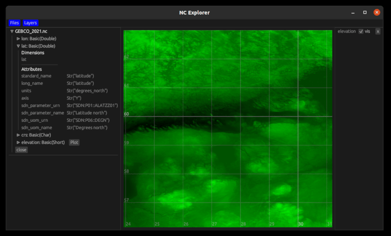
NC Explorer
Tool to visualize geo-referenced data from NetCDF files.
Installation
Either download the binary for Windows and Linux from the Releases page
Or if you have cargo installed:
cargo install nc_explorer
Requires at least rust 1.59
Usage
Drag-and-drop files you want to plot onto the nc_explorer window, or use "open with" dialog.
Variables that have latitude and longitude in dimensions will have a Plot button next to them. Click it to see the data.
Status
This is in a proof-of-concept stage. Please do not hesitate to create issues if something does not work or if you want to add something.
The code is in a pretty rough shape and will be re-organized, I will be accepting merge requests after that.
Dependencies
~65MB
~1M SLoC